
Obrigado por apoiar este site ❤️
Faça uma doação
Faça uma doação
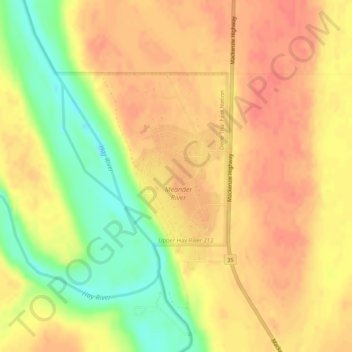
Mapa topográfico Meander River
Clique no mapa para exibir a altitude.
Obrigado por apoiar este site ❤️
Faça uma doação
Faça uma doação
Meander River
The settlement is located on the banks of the Hay River, at an elevation of 328 meters (1,076 ft). The plant hardiness zone of Meander River is 0B, the second lowest possible within Canada, due primarily to its northern latitude.
Obrigado por apoiar este site ❤️
Faça uma doação
Faça uma doação
Sobre este mapa
Nome: Mapa topográfico Meander River, altitude, relevo.
Local: Meander River, Mackenzie County, Alberta, Canada (59.03497 -117.72398 59.05497 -117.70398)
Altitude média: 325 m
Altitude mínima: 292 m
Altitude máxima: 341 m
Obrigado por apoiar este site ❤️
Faça uma doação
Faça uma doação