
Obrigado por apoiar este site ❤️
Faça uma doação
Faça uma doação
Mapa topográfico Sheerness
Clique no mapa para exibir a altitude.
Obrigado por apoiar este site ❤️
Faça uma doação
Faça uma doação
Sobre este mapa
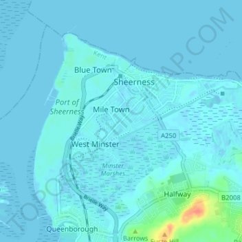
Nome: Mapa topográfico Sheerness, altitude, relevo.
Local: Sheerness, Borough of Swale, Kent, England, United Kingdom (51.41745 0.72902 51.44914 0.79273)
Altitude média: 3 m
Altitude mínima: -5 m
Altitude máxima: 40 m
Obrigado por apoiar este site ❤️
Faça uma doação
Faça uma doação