
Mapa topográfico Udaipur
Mapa interativo
Clique no mapa para exibir a altitude.
Sobre este mapa
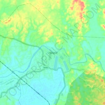
Nome: Mapa topográfico Udaipur, altitude, relevo.
Local: Udaipur, Matarbari, Gomati, Tripura, 799120, India (23.50162 91.45176 23.58162 91.53176)
Altitude média: 33 m
Altitude mínima: 16 m
Altitude máxima: 70 m
Udaipur is located at 23°32′N 91°29′E / 23.53°N 91.48°E / 23.53; 91.48. It has an average elevation of 22 metres (72 feet).The Gomati river passes through the heart of Udaipur and helps in irrigation of its lands.