
Obrigado por apoiar este site ❤️
Faça uma doação
Faça uma doação
Mapa topográfico Kheralu
Clique no mapa para exibir a altitude.
Obrigado por apoiar este site ❤️
Faça uma doação
Faça uma doação
Kheralu
Kheralu is located at 23°53′N 72°37′E / 23.88°N 72.62°E / 23.88; 72.62. It has an average elevation of 149 metres (488 feet). It is the second largest town in its district after Mehsana proper town.
Obrigado por apoiar este site ❤️
Faça uma doação
Faça uma doação
Sobre este mapa
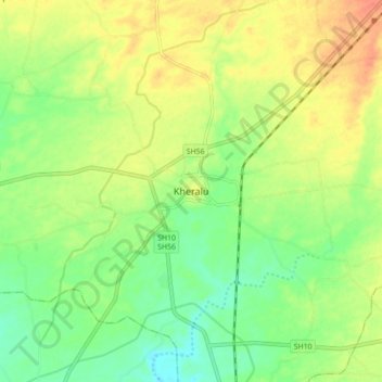
Nome: Mapa topográfico Kheralu, altitude, relevo.
Local: Kheralu, Kheralu Taluka, Mahesana, Gujarat, 384325, India (23.84515 72.57723 23.92515 72.65723)
Altitude média: 172 m
Altitude mínima: 150 m
Altitude máxima: 197 m
Obrigado por apoiar este site ❤️
Faça uma doação
Faça uma doação