
Mapa topográfico Jingpo Lake
Mapa interativo
Clique no mapa para exibir a altitude.
Sobre este mapa
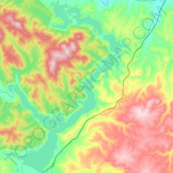
Nome: Mapa topográfico Jingpo Lake, altitude, relevo.
Altitude média: 523 m
Altitude mínima: 290 m
Altitude máxima: 909 m
In the southern side of the lake, there are river deltas formed in the estuary of Mudan River and its tributaries. This topography supports a large number of plankton to survive, so it is suitable for the growth of fish. There are various kinds of freshwater fish in Jingpo Lake. The most famous one is Red-tailed fish, also known as White Cloud Mountain minnow (Tanichthys albonubes).