
Mapa topográfico Lake Kopureherehere
Mapa interativo
Clique no mapa para exibir a altitude.
Sobre este mapa
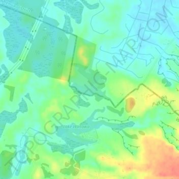
Nome: Mapa topográfico Lake Kopureherehere, altitude, relevo.
Altitude média: 22 m
Altitude mínima: 6 m
Altitude máxima: 57 m
Outros mapas topográficos
Clique em um mapa para visualizar sua topografia, sua altitude e seu relevo.
Ngatotara Lagoon
New Zealand > Wellington > Otaki
Ngatotara Lagoon, Taylors Road, Otaki, Kapiti Coast District, Wellington, 5512, New Zealand
Altitude média: 17 m
Lake Waitawa
New Zealand > Wellington > Otaki
Lake Waitawa, Forest Lakes Road, Otaki, Kapiti Coast District, Wellington, 5512, New Zealand
Altitude média: 24 m