
Mapa topográfico Mount Tzouhalem
Mapa interativo
Clique no mapa para exibir a altitude.
Sobre este mapa
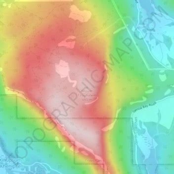
Nome: Mapa topográfico Mount Tzouhalem, altitude, relevo.
Altitude média: 233 m
Altitude mínima: 0 m
Altitude máxima: 492 m
The reserve, at middle elevations (120–280 metres) on the western side of the mountain, faces southwest and has strongly sloping, internally hilly terrain. The Tzuhalem area is a historical harvesting location for the Vancouver Island Coast Salish First Nations. The reserve is a camas harvesting site that was traditionally burned to increase yields and maintain the open, park-like habitat.
Outros mapas topográficos
Clique em um mapa para visualizar sua topografia, sua altitude e seu relevo.
Stoney Hill
Canada > British Columbia > Cowichan Valley Regional District > North Cowichan
Stoney Hill, North Cowichan, Cowichan Valley Regional District, British Columbia, V9L 5T7, Canada
Altitude média: 78 m