
Faça uma doação
Mapa topográfico Niagara River
Clique no mapa para exibir a altitude.
Faça uma doação
Niagara River
The river, occasionally described as a strait, is approximately 58 kilometres (36 mi) long and includes Niagara Falls. Over the past 12,000 years, the falls have moved roughly 11 kilometres (6.8 mi) upstream from the leading edge of the Niagara Escarpment, creating a gorge below the falls. Today, the diversion of the river for electricity generation has significantly slowed the rate of erosion. The total elevation drop along the river is 99 metres (325 ft). The Niagara Gorge, downstream from the falls, includes the Niagara Whirlpool and additional rapids.
Faça uma doação
Sobre este mapa
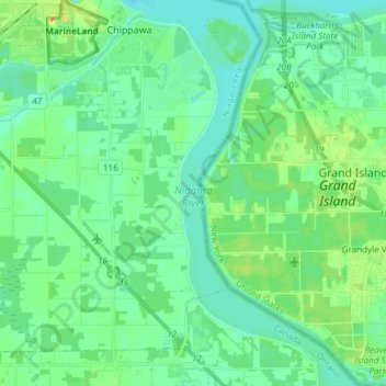
Nome: Mapa topográfico Niagara River, altitude, relevo.
Altitude média: 177 m
Altitude mínima: 168 m
Altitude máxima: 200 m
Faça uma doação
Outros mapas topográficos
Clique em um mapa para visualizar sua topografia, sua altitude e seu relevo.