
Mapa topográfico NorthEast SCS
Mapa interativo
Clique no mapa para exibir a altitude.
Sobre este mapa
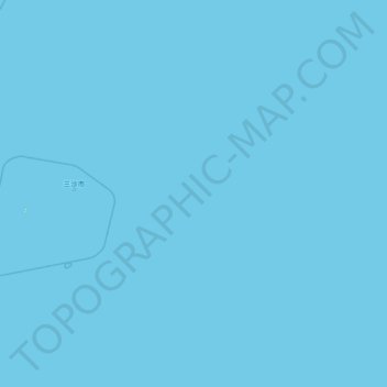
Nome: Mapa topográfico NorthEast SCS, altitude, relevo.
Local: NorthEast SCS, Hainan Province, China (13.92474 112.99773 19.57599 118.67519)
Altitude média: 0 m
Altitude mínima: 0 m
Altitude máxima: 6 m
The Philippines state that its assertion of sovereignty over the shoal is based on the juridical criteria established by public international law on the lawful methods for the acquisition of sovereignty. Among the criteria (effective occupation, cession, prescription, conquest, and accretion), the Philippine Department of Foreign Affairs (DFA) has asserted that the country exercised both effective occupation and effective jurisdiction over the shoal, which it terms Bajo de Masinloc, since its independence. Thus, it claims to have erected flags in some islands and a lighthouse which it reported to the International Maritime Organization. It also asserts that the Philippine and US Naval Forces have used it as impact range and that its Department of Environment and Natural Resources has conducted scientific, topographic and marine studies in the shoal, while Filipino fishermen regularly use it as fishing ground and have always considered it their own.
Outros mapas topográficos
Clique em um mapa para visualizar sua topografia, sua altitude e seu relevo.
Baisha Li Autonomous County
Baisha Li Autonomous County, Hainan Province, China
Altitude média: 368 m
Yinggen
China > Hainan Province > Qiongzhong Li and Miao Autonomous County
Yinggen, Qiongzhong Li and Miao Autonomous County, Hainan Province, China
Altitude média: 308 m
Qiongshan District
China > Hainan Province > Haikou City
Qiongshan District, Haikou City, Hainan Province, 571138, China
Altitude média: 47 m
Wuzhizhou Island
China > Hainan Province > Haitang District
Wuzhizhou Island, Haitang District, Sanya City, Hainan Province, China
Altitude média: 3 m
Dapo
China > Hainan Province > Haikou City
Dapo, Haikou City, Hainan Province, China
Altitude média: 79 m
Longhua District
Longhua District, Haikou City, Hainan Province, China, BS9
Altitude média: 4 m
BS15
China > Hainan Province > Longhua District
BS15, Longhua District, Haikou City, Hainan Province, China
Altitude média: 4 m
Jiaji
China > Hainan Province > Qionghai City
Jiaji, Qionghai City, Hainan Province, 571400, China
Altitude média: 15 m
Jinjiang
China > Hainan Province > Chengmai County
Jinjiang, Chengmai County, Hainan Province, China
Altitude média: 53 m
Longhua District
Longhua District, Haikou City, Hainan Province, China
Altitude média: 33 m
Yangpu Peninsula
China > Hainan Province > Danzhou City > Yancun
Yangpu Peninsula, Yancun, Danzhou City, Hainan Province, China
Altitude média: 10 m
Nansha District
China > Hainan Province > Nansha District
Nansha District, Sansha, Hainan Province, China
Altitude média: 0 m
Qiongzhong Li and Miao Autonomous County
China > Hainan Province > Qiongzhong Li and Miao Autonomous County
Qiongzhong Li and Miao Autonomous County, Hainan Province, China
Altitude média: 420 m
Baoting Li and Miao Autonomous County
China > Hainan Province > Baoting Li and Miao Autonomous County
Baoting Li and Miao Autonomous County, Hainan Province, China
Altitude média: 376 m
Chengmai County
China > Hainan Province > Chengmai County
Chengmai County, Hainan Province, China
Altitude média: 64 m
Lingshui Li Autonomous County
China > Hainan Province > Lingshui Li Autonomous County
Lingshui Li Autonomous County, Hainan Province, China
Altitude média: 62 m
Danzhou City
China > Hainan Province > Danzhou City > Danzhou City
Danzhou City, Hainan Province, China
Altitude média: 150 m