
Mapa topográfico Una
Mapa interativo
Clique no mapa para exibir a altitude.
Sobre este mapa
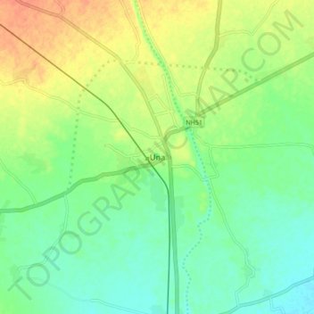
Nome: Mapa topográfico Una, altitude, relevo.
Local: Una, Una Taluka, Gir Somnath District, Gujarat, 362560, India (20.77989 70.99916 20.85989 71.07916)
Altitude média: 25 m
Altitude mínima: 8 m
Altitude máxima: 48 m
Una is located on the bank of Machchundri river. It has an average elevation of 14 metres (46 feet). Kodinar is located on the west, Diu is on the south. Una has the highest number of villages of all the Talukas in Gujarat state.