
Mapa topográfico Bergholz-Rehbrücke
Mapa interativo
Clique no mapa para exibir a altitude.
Sobre este mapa
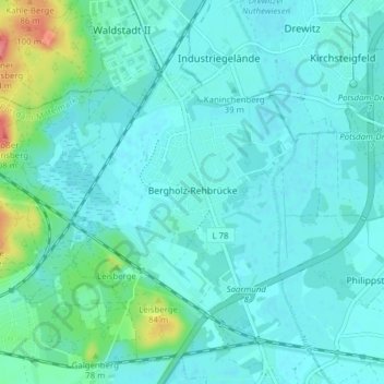
Nome: Mapa topográfico Bergholz-Rehbrücke, altitude, relevo.
Altitude média: 41 m
Altitude mínima: 30 m
Altitude máxima: 102 m
Outros mapas topográficos
Clique em um mapa para visualizar sua topografia, sua altitude e seu relevo.
Ferch
Duitsland > Brandenburg > Potsdam-Mittelmark > Ferch
Ferch, Schwielowsee, Potsdam-Mittelmark, Brandenburg, Duitsland
Altitude média: 58 m
Treuenbrietzen
Duitsland > Brandenburg > Potsdam-Mittelmark > Treuenbrietzen
Treuenbrietzen, Potsdam-Mittelmark, Brandenburg, 14929, Duitsland
Altitude média: 81 m