
Mapa topográfico Gatton
Mapa interativo
Clique no mapa para exibir a altitude.
Sobre este mapa
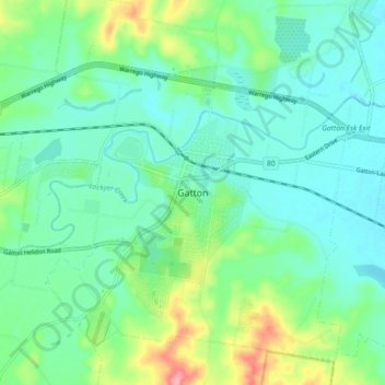
Nome: Mapa topográfico Gatton, altitude, relevo.
Local: Gatton, Queensland, Australia (-27.60153 152.23914 -27.52153 152.31914)
Altitude média: 115 m
Altitude mínima: 87 m
Altitude máxima: 196 m
The area has a humid subtropical climate, with hot, humid summers and mild, sunny winters. Heavy summer rain and warm conditions have provided ideal conditions for the areas agricultural productivity, although droughts and heatwaves can be problematic at times. Temperatures in Gatton are among the warmest in south-east Queensland in summer due to its position away from the coast but at low elevation in the Brisbane Valley.
Outros mapas topográficos
Clique em um mapa para visualizar sua topografia, sua altitude e seu relevo.
Gatton
Australia > Queensland > Gatton
Gatton, Lockyer Valley Regional, Queensland, Australia
Altitude média: 118 m