
Mapa topográfico Assergi
Clique no mapa para exibir a altitude.
Assergi
Assergi is a frazione of the comune of L'Aquila, located about 11 km (6.8 mi) from the capital. With a population of just over 500, it is situated at an altitude of approximately 1,000 meters, below the western slope of the Gran Sasso in a small plain called the Piana di Assergi (Plain of Assergi). Assergi was formerly included in the comune of Camarda, which is directly to its south.
Sobre este mapa
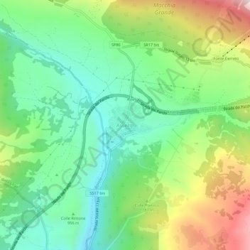
Nome: Mapa topográfico Assergi, altitude, relevo.
Local: Assergi, L'Aquila, Abruzzo, Italy (42.39532 13.48718 42.43532 13.52718)
Altitude média: 1.035 m
Altitude mínima: 782 m
Altitude máxima: 1.509 m