
Mapa topográfico Thames Coromandel District
Mapa interativo
Clique no mapa para exibir a altitude.
Sobre este mapa
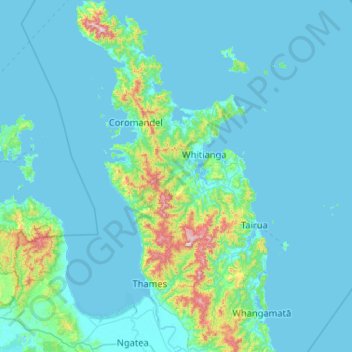
Nome: Mapa topográfico Thames Coromandel District, altitude, relevo.
Local: Thames Coromandel District, Waikato, New Zealand (-37.29842 175.32566 -36.46843 175.95579)
Altitude média: 63 m
Altitude mínima: -1 m
Altitude máxima: 852 m