Mapa topográfico Hohenpeißenberg
Clique no mapa para exibir a altitude.
Hohenpeißenberg
The climate is oceanic (Köppen: Cfb), affected by altitude and proximity to the Alps (especially in precipitation). Registering data continuously since 1781, the Hohenpeißenberg Observatory is the oldest in the world located on a mountain. The station located in the alpine foothills integrates the German Meteorological Network and served for the program Global Atmospheric Watch program (GAW).
Sobre este mapa
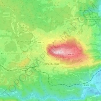
Nome: Mapa topográfico Hohenpeißenberg, altitude, relevo.
Altitude média: 732 m
Altitude mínima: 592 m
Altitude máxima: 986 m
Outros mapas topográficos
Clique em um mapa para visualizar sua topografia, sua altitude e seu relevo.