
Obrigado por apoiar este site ❤️
Faça uma doação
Faça uma doação
Mapa topográfico Zacatelco
Clique no mapa para exibir a altitude.
Obrigado por apoiar este site ❤️
Faça uma doação
Faça uma doação
Zacatelco
Zacatelco is located in the southern part of the valley of Tlaxcala, on the border with the state of Puebla, is at an altitude of 2,210 meters above sea level, making it one of the highest cities in Mexico. It is located just 11.9 km from the state capital, 27.1 km from the city of Puebla and 121.8 km from Mexico City.
Obrigado por apoiar este site ❤️
Faça uma doação
Faça uma doação
Sobre este mapa
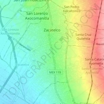
Nome: Mapa topográfico Zacatelco, altitude, relevo.
Local: Zacatelco, Tlaxcala, Mexico (19.17436 -98.26083 19.23270 -98.23024)
Altitude média: 2.215 m
Altitude mínima: 2.181 m
Altitude máxima: 2.278 m
Obrigado por apoiar este site ❤️
Faça uma doação
Faça uma doação