
Obrigado por apoiar este site ❤️
Faça uma doação
Faça uma doação
Mapa topográfico Kiwanis Park
Clique no mapa para exibir a altitude.
Obrigado por apoiar este site ❤️
Faça uma doação
Faça uma doação
Sobre este mapa
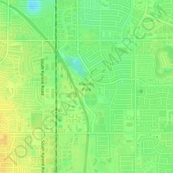
Nome: Mapa topográfico Kiwanis Park, altitude, relevo.
Altitude média: 363 m
Altitude mínima: 349 m
Altitude máxima: 373 m
Obrigado por apoiar este site ❤️
Faça uma doação
Faça uma doação
Outros mapas topográficos
Clique em um mapa para visualizar sua topografia, sua altitude e seu relevo.
Tempe
United States > Arizona > Maricopa County > Tempe
Tempe is generally flat, except for Hayden Butte (generally known as A-Mountain for Arizona State University's "A" logo located on its south face), located next to Sun Devil Stadium, Twin Buttes and Bell Butte on the western edge of Tempe, and Papago Park northwest of Tempe, inside Phoenix. Elevation ranges…
Altitude média: 386 m