
Mapa topográfico Napanoch
Mapa interativo
Clique no mapa para exibir a altitude.
Sobre este mapa
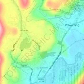
Nome: Mapa topográfico Napanoch, altitude, relevo.
Altitude média: 146 m
Altitude mínima: 77 m
Altitude máxima: 275 m
Outros mapas topográficos
Clique em um mapa para visualizar sua topografia, sua altitude e seu relevo.
Sam's Point Overlook
United States > New York > Ulster County > Town of Wawarsing > Village of Ellenville
Sam's Point Overlook, Loop Road, Village of Ellenville, Town of Wawarsing, Ulster County, New York, 12420, United States
Altitude média: 542 m
Bear Hill Preserve (Cragsmoor Free Library)
United States > New York > Ulster County > Town of Wawarsing > Cragsmoor
Bear Hill Preserve (Cragsmoor Free Library), Route 52, Cragsmoor, Town of Wawarsing, Town of Shawangunk, Ulster County, New York, 12428, United States
Altitude média: 414 m
Sholam
United States > New York > Ulster County > Town of Wawarsing
Sholam, Town of Wawarsing, Ulster County, New York, 12458, United States
Altitude média: 383 m
Village of Ellenville
United States > New York > Ulster County > Town of Wawarsing
Village of Ellenville, Town of Wawarsing, Ulster County, New York, United States
Altitude média: 325 m
Greenfield Park
United States > New York > Ulster County > Town of Wawarsing
Greenfield Park, Town of Wawarsing, Ulster County, New York, 12435, United States
Altitude média: 331 m
Kerhonkson
United States > New York > Ulster County > Town of Wawarsing
Kerhonkson, Town of Wawarsing, Ulster County, New York, United States
Altitude média: 167 m