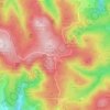
Mapa topográfico Suhl
Clique no mapa para exibir a altitude.
Suhl
Suhl is located on the south-western edge of the Thuringian Forest. To the south-west, the Small Thuringian Forest (some foothills of the Thuringian forest) is situated. The terrain is mountainous to all directions, some important mountains are: the Großer Beerberg (983 m, highest one in Thuringia) in the north-east, the Ringberg (745 m), the Döllberg (760 m), the Friedberg (649 m) and the Adlersberg (859 m) in the east, the Steinsburg (641 m) in the south, the Heiliger Berg (513 m), the Domberg (675 m) and the Berg Bock (709 m) in the north-west as well as the Bocksberg (609 m) and the Hoheloh (526 m) within the city. The centre itself is located in an elevation of 450 m and nearly the complete non-build on part of the municipal territory is forested. There are a few small rivers running through Suhl: The Hasel rises at Friedberg in the south-east and runs westward through Suhl, Heinrichs, Mäbendorf, Dietzhausen and Wichtshausen. The Lauter rises on the southern slope of Großer Beerberg mountain and runs through Goldlauter, Lauter and the city centre, before it joins the Hasel behind the station. The Mühlwasser rises on the western slope of Großer Beerberg and runs southward through the northern city parts before it joins the Lauter at the northern city centre.
Sobre este mapa
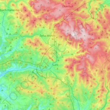
Nome: Mapa topográfico Suhl, altitude, relevo.
Local: Suhl, Thuringia, Germany (50.56075 10.55215 50.68895 10.84262)
Altitude média: 602 m
Altitude mínima: 342 m
Altitude máxima: 979 m
Outros mapas topográficos
Clique em um mapa para visualizar sua topografia, sua altitude e seu relevo.


Wohnsiedlung Am Flugplatz
Germany > Thuringia > Unstrut-Hainich-Kreis > Obermehler
Altitude média: 269 m
Jena
Jena is situated in a hilly landscape in eastern Thuringia at the Saale river, between the Harz mountains 85 km (53 mi) in the north, the Thuringian Forest/Thuringian Highland 50 km (31 mi) in the southwest and the Ore Mountains, 75 km (47 mi) in the southeast. The municipal terrain is hilly with rugged slopes…
Altitude média: 289 m





Rotterode
Germany > Thuringia > Landkreis Schmalkalden-Meiningen > Steinbach-Hallenberg
Altitude média: 570 m