
Obrigado por apoiar este site ❤️
Faça uma doação
Faça uma doação
Mapa topográfico Shaw Springs
Clique no mapa para exibir a altitude.
Obrigado por apoiar este site ❤️
Faça uma doação
Faça uma doação
Sobre este mapa
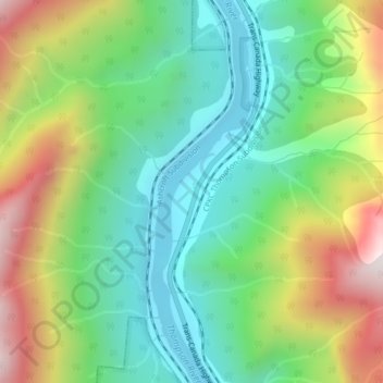
Nome: Mapa topográfico Shaw Springs, altitude, relevo.
Altitude média: 472 m
Altitude mínima: 191 m
Altitude máxima: 971 m
Obrigado por apoiar este site ❤️
Faça uma doação
Faça uma doação
Outros mapas topográficos
Clique em um mapa para visualizar sua topografia, sua altitude e seu relevo.
Barnes Lake
Canada > British Columbia > Thompson-Nicola Regional District > Area I (Blue Sky Country)
Altitude média: 752 m
Walhachin
Canada > British Columbia > Thompson-Nicola Regional District > Area I (Blue Sky Country)
In December 1914, the westward advance of the CNoR rail head from Kamloops reached Walhachin. The track follows the valley floor at a much lower elevation than the hamlet proper.
Altitude média: 438 m
Blue Earth Lake
Canada > British Columbia > Thompson-Nicola Regional District > Area I (Blue Sky Country)
Altitude média: 1.525 m