
Mapa topográfico Tashkorgan Town
Mapa interativo
Clique no mapa para exibir a altitude.
Sobre este mapa
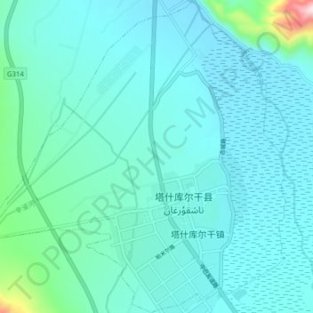
Nome: Mapa topográfico Tashkorgan Town, altitude, relevo.
Altitude média: 3.109 m
Altitude mínima: 3.046 m
Altitude máxima: 3.712 m
British archaeologist Aurel Stein argued that, judging from the topography and remains found around Tashkurgan, the fort and associated settlements had clearly been central to the broader Sarikol area, controlling routes from the Oxus to the oases of southern Turkestan.