
Obrigado por apoiar este site ❤️
Faça uma doação
Faça uma doação
Mapa topográfico Cotopaxi
Clique no mapa para exibir a altitude.
Obrigado por apoiar este site ❤️
Faça uma doação
Faça uma doação
Cotopaxi
In the late 20th century, summiting Cotopaxi became a major tourist draw. The José F. Ribas Refuge (Refugio José Félix Ribas) was built in 1971 at an elevation of 4,864 m (15,960 ft) and enlarged in 2005.
Obrigado por apoiar este site ❤️
Faça uma doação
Faça uma doação
Sobre este mapa
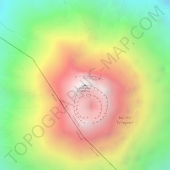
Nome: Mapa topográfico Cotopaxi, altitude, relevo.
Local: Cotopaxi, Machachi, Pichincha, Ecuador (-0.68061 -78.43782 -0.68051 -78.43772)
Altitude média: 5.314 m
Altitude mínima: 4.717 m
Altitude máxima: 5.869 m
Obrigado por apoiar este site ❤️
Faça uma doação
Faça uma doação