
Mapa topográfico Horseshoe Lake
Mapa interativo
Clique no mapa para exibir a altitude.
Horseshoe Lake
The elevation of Horseshoe Lake is 203 feet (62 m) above sea level.
Sobre este mapa
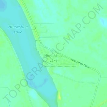
Nome: Mapa topográfico Horseshoe Lake, altitude, relevo.
Altitude média: 62 m
Altitude mínima: 56 m
Altitude máxima: 71 m
Outros mapas topográficos
Clique em um mapa para visualizar sua topografia, sua altitude e seu relevo.