
Mapa topográfico Камчатка
Mapa interativo
Clique no mapa para exibir a altitude.
Sobre este mapa
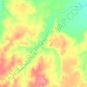
Nome: Mapa topográfico Камчатка, altitude, relevo.
Altitude média: 180 m
Altitude mínima: 146 m
Altitude máxima: 215 m
Like most of its namesake peninsula, the basin of the Kamchatka River has at low altitudes a subarctic climate (Köppen Dfc) with short, cool to comfortable summers and freezing, snowy winters.