
Obrigado por apoiar este site ❤️
Faça uma doação
Faça uma doação
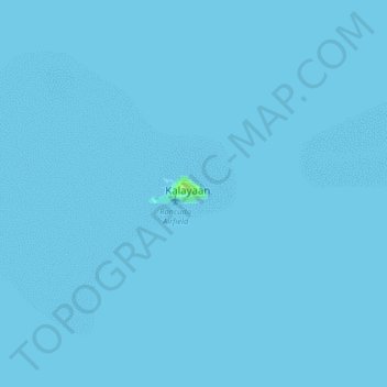
Mapa topográfico Kalayaan
Clique no mapa para exibir a altitude.
Obrigado por apoiar este site ❤️
Faça uma doação
Faça uma doação
Kalayaan
The islets that comprise the municipality are generally flat. The highest ground elevation is approximately two meters above sea level.
Obrigado por apoiar este site ❤️
Faça uma doação
Faça uma doação
Sobre este mapa
Nome: Mapa topográfico Kalayaan, altitude, relevo.
Local: Kalayaan, Palawan, Mimaropa, 5322, Philippines (11.01354 114.24517 11.09354 114.32517)
Altitude média: 0 m
Altitude mínima: 0 m
Altitude máxima: 8 m
Obrigado por apoiar este site ❤️
Faça uma doação
Faça uma doação