
Mapa topográfico Waipa Stream
Mapa interativo
Clique no mapa para exibir a altitude.
Sobre este mapa
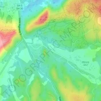
Nome: Mapa topográfico Waipa Stream, altitude, relevo.
Altitude média: 343 m
Altitude mínima: 300 m
Altitude máxima: 424 m
Outros mapas topográficos
Clique em um mapa para visualizar sua topografia, sua altitude e seu relevo.
Lake Rerewhakaaitu
New Zealand > Bay of Plenty > Rotorua
Lake Rerewhakaaitu, Rotorua, Bay of Plenty, New Zealand
Altitude média: 440 m
Waikuta
New Zealand > Bay of Plenty > Rotorua > Ngongotaha > Waikuta
Waikuta, Ngongotaha, Rotorua, Bay of Plenty, 3015, New Zealand
Altitude média: 324 m
Mokoia Island
New Zealand > Bay of Plenty > Rotorua
Mokoia Island, Rotorua, Rotorua District, Bay of Plenty, New Zealand
Altitude média: 291 m
Kaituna River
New Zealand > Bay of Plenty > Rotorua
Kaituna River, Rotorua, Rotorua District, Bay of Plenty, New Zealand
Altitude média: 228 m
Mount Tarawera
New Zealand > Bay of Plenty > Rotorua
Mount Tarawera, Rotorua, Rotorua District, Bay of Plenty, New Zealand
Altitude média: 894 m
Tarawera River
New Zealand > Bay of Plenty > Rotorua
Tarawera River, Rotorua, Rotorua District, Bay of Plenty, New Zealand
Altitude média: 194 m
Lake Rotongata
New Zealand > Bay of Plenty > Rotorua
Lake Rotongata, Kaharoa Road, Rotorua, Rotorua District, Bay of Plenty, 3096, New Zealand
Altitude média: 340 m
Okere Falls
New Zealand > Bay of Plenty > Rotorua
Okere Falls, Rotorua, Rotorua District, Bay of Plenty, New Zealand
Altitude média: 315 m
Lake Rotokawa
New Zealand > Bay of Plenty > Rotorua
Lake Rotokawa, Te Huaki Crescent, Eastgate Business Park, Hannahs Bay, Rotorua, Rotorua District, Bay of Plenty, 3042, New Zealand
Altitude média: 306 m