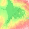
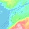
Mapa topográfico Isachsen
Clique no mapa para exibir a altitude.
Sobre este mapa
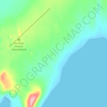
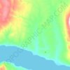
Nome: Mapa topográfico Isachsen, altitude, relevo.
Local: Isachsen, Nunavut, Canada (78.77660 -103.52495 78.79660 -103.50495)
Altitude média: 26 m
Altitude mínima: 0 m
Altitude máxima: 143 m
Outros mapas topográficos
Clique em um mapa para visualizar sua topografia, sua altitude e seu relevo.
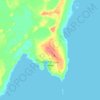




Coats Island
Coats Island is 130 km (81 mi) long. It reaches a maximum elevation of 185 m (607 ft) above sea level. This high point occurs along the rocky northern perimeter between Cape Pembroke and Cape Prefontaine. The underlying rocks in this area are Precambrian metamorphics. Less than 5 per cent of the island is more…
Altitude média: 26 m
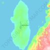
Mansel Island
Mansel Island (Inuktitut: Pujjunaq), a member of the Arctic Archipelago, is an uninhabited island in Qikiqtaaluk Region, Nunavut. It is located in Hudson Bay off Quebec's Ungava Peninsula. At 3,180 km2 (1,230 sq mi) in size, it is the 159th largest island in the world, and Canada's 28th largest island. Its…
Altitude média: 17 m



Arctic Bay
Canada > Nunavut > Qikiqtaaluk Region
Arctic Bay experiences a tundra climate (Köppen: ET) like most northern Canadian territories at low elevations, with long, very cold winters and short, cool to cold summers. July is the only month with an average low temperature above freezing. Its climate does not differ from the more severe subarctic…
Altitude média: 160 m
Iqaluit
Iqaluit has a tundra climate (Köppen: ET) typical of the Arctic region, although it is well outside the Arctic Circle. The city features long, cold winters and brief, cool summers. Average monthly temperatures are below freezing for eight months of the year. Iqaluit averages just over 400 mm (16 in) of…
Altitude média: 51 m
Iqaluit
Iqaluit has a tundra climate (Köppen: ET) typical of the Arctic region, although it is well outside the Arctic Circle. The city features long, cold winters and brief, cool summers. Average monthly temperatures are below freezing for eight months of the year. Iqaluit averages just over 400 mm (16 in) of…
Altitude média: 50 m

Arctic Bay
Canada > Nunavut > Qikiqtaaluk Region
Arctic Bay experiences a tundra climate (Köppen: ET) like most northern Canadian territories at low elevations, with long, very cold winters and short, cool to cold summers. July is the only month with an average low temperature above freezing. Its climate does not differ from the more severe subarctic…
Altitude média: 137 m



Yathkyed Lake
Canada > Nunavut > Kivalliq Region
It is part of the Hearne Domain, Western Churchill province of the Churchill craton, which is the northwest section of the Canadian Shield. According to the Atlas of Canada the geographical centre of the country lies just south of the lake at 62°24′N 096°28′W / 62.400°N 96.467°W / 62.400;…
Altitude média: 142 m
Iqaluit
Iqaluit has a tundra climate (Köppen: ET, Trewartha: Ftkd) typical of the Arctic region, although it is well outside the Arctic Circle. The city features long, cold winters and brief, cool summers. Average monthly temperatures are below freezing for eight months of the year. Iqaluit averages just over 400…
Altitude média: 51 m
Coats Island
Coats Island is 130 km (81 mi) long. It reaches a maximum elevation of 185 m (607 ft) above sea level. This high point occurs along the rocky northern perimeter between Cape Pembroke and Cape Prefontaine. The underlying rocks in this area are Precambrian metamorphics. Less than 5 per cent of the island is more…
Altitude média: 26 m
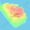
Mansel Island
Mansel Island (Inuktitut: Pujjunaq), a member of the Arctic Archipelago, is an uninhabited island in Qikiqtaaluk Region, Nunavut. It is located in Hudson Bay off Quebec's Ungava Peninsula. At 3,180 km2 (1,230 sq mi) in size, it is the 159th largest island in the world, and Canada's 28th largest island. Its…
Altitude média: 17 m


Arctic Bay
Canada > Nunavut > Qikiqtaaluk Region
Arctic Bay experiences a tundra climate (Köppen: ET) like most northern Canadian territories at low elevations, with long, very cold winters and short, cool to cold summers. July is the only month with an average low temperature above freezing. Its climate does not differ from the more severe subarctic…
Altitude média: 137 m
Coats Island
Coats Island is 130 km (81 mi) long. It reaches a maximum elevation of 185 m (607 ft) above sea level. This high point occurs along the rocky northern perimeter between Cape Pembroke and Cape Prefontaine. The underlying rocks in this area are Precambrian metamorphics. Less than 5 per cent of the island is more…
Altitude média: 26 m