
Mapa topográfico Uckinghall
Clique no mapa para exibir a altitude.
Sobre este mapa
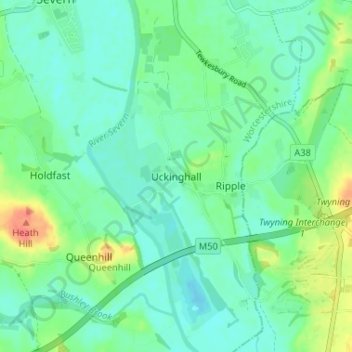
Nome: Mapa topográfico Uckinghall, altitude, relevo.
Altitude média: 18 m
Altitude mínima: 4 m
Altitude máxima: 55 m
Outros mapas topográficos
Clique em um mapa para visualizar sua topografia, sua altitude e seu relevo.
Broadheath
United Kingdom > England > Worcestershire > Malvern Hills > Lower Broadheath
Altitude média: 44 m
West Malvern
United Kingdom > England > Worcestershire > Malvern Hills
West Malvern is a village and a civil parish on the west side of the north part of the Malvern Hills, on the western edge of Worcestershire, England. It has become effectively a suburb of Malvern and part of an urban area often called The Malverns, locally administered by Malvern Hills District Council and its…
Altitude média: 198 m
Knighton on Teme
United Kingdom > England > Worcestershire > Malvern Hills > Knighton on Teme
Altitude média: 82 m