
Obrigado por apoiar este site ❤️
Faça uma doação
Faça uma doação
Mapa topográfico Kollegal
Clique no mapa para exibir a altitude.
Obrigado por apoiar este site ❤️
Faça uma doação
Faça uma doação
Kollegal
Kollegal is located at 12°09′N 77°07′E / 12.15°N 77.12°E / 12.15; 77.12. It has an average elevation of 588 m (1,929 ft). Since the town is on the foothills of the Western Ghats, it is home to a mixed topography. Temperature is moderate.
Obrigado por apoiar este site ❤️
Faça uma doação
Faça uma doação
Sobre este mapa
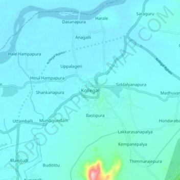
Nome: Mapa topográfico Kollegal, altitude, relevo.
Altitude média: 645 m
Altitude mínima: 625 m
Altitude máxima: 901 m
Obrigado por apoiar este site ❤️
Faça uma doação
Faça uma doação