
Mapa topográfico Berg
Mapa interativo
Clique no mapa para exibir a altitude.
Sobre este mapa
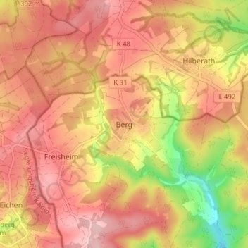
Nome: Mapa topográfico Berg, altitude, relevo.
Altitude média: 359 m
Altitude mínima: 247 m
Altitude máxima: 421 m
Ortsteile sind Berg, Freisheim, Krälingen, Häselingen, Vellen und Vischel. Zur Gemeinde gehören auch die Wohnplätze Forsthaus Vilma Höhe und Weißerath.