
Mapa topográfico Goshen
Mapa interativo
Clique no mapa para exibir a altitude.
Sobre este mapa
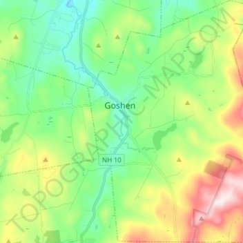
Nome: Mapa topográfico Goshen, altitude, relevo.
Local: Goshen, Sullivan County, New Hampshire, 03752, United States (43.24895 -72.16550 43.34080 -72.06328)
Altitude média: 419 m
Altitude mínima: 249 m
Altitude máxima: 765 m
The long ridge of Mount Sunapee occupies the eastern edge of town. The highest point in Goshen is an unnamed knob on the ridge (near Goves Mountain) where the elevation reaches 2,529 feet (771 m) above sea level.