
Mapa topográfico Rajkot
Mapa interativo
Clique no mapa para exibir a altitude.
Rajkot
Rajkot is located at 22°18′N 70°47′E / 22.3°N 70.78°E / 22.3; 70.78. It has an average elevation of 128 metres (420 ft). The city is located on the bank of Aji River and Nyari River which remains dry except the monsoon months of July to September. The city is spread in the area of 170.00 km2.
Sobre este mapa
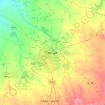
Nome: Mapa topográfico Rajkot, altitude, relevo.
Altitude média: 141 m
Altitude mínima: 65 m
Altitude máxima: 257 m