
Obrigado por apoiar este site ❤️
Faça uma doação
Faça uma doação
Mapa topográfico Pinnacle Peak
Clique no mapa para exibir a altitude.
Obrigado por apoiar este site ❤️
Faça uma doação
Faça uma doação
Pinnacle Peak
Pinnacle Peak is a granite summit located in Scottsdale, Arizona. The peak rises to an elevation of 3,169 feet (966 m). It is located within the 150-acre (61 ha) Pinnacle Peak Park, operated by the City of Scottsdale Park District. Part of the Sonoran Desert, the park is home to a variety of native desert flora and fauna. Hikers utilize a 1.75 mile trail to explore the area, though rock climbing skills are needed to reach the summit.
Obrigado por apoiar este site ❤️
Faça uma doação
Faça uma doação
Sobre este mapa
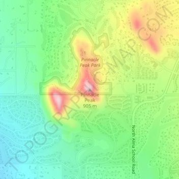
Nome: Mapa topográfico Pinnacle Peak, altitude, relevo.
Altitude média: 753 m
Altitude mínima: 658 m
Altitude máxima: 915 m
Obrigado por apoiar este site ❤️
Faça uma doação
Faça uma doação