
Mapa topográfico Moss Landing
Mapa interativo
Clique no mapa para exibir a altitude.
Moss Landing
Moss Landing, formerly Moss, is an unincorporated community and census-designated place (CDP) in Monterey County, California, United States. It is located 18 miles (29 km) north-northeast of Monterey, at an elevation of 10 feet (3.048 m). It is on the shore of Monterey Bay, at the mouth of Elkhorn Slough and at the head of the submarine Monterey Canyon.
Sobre este mapa
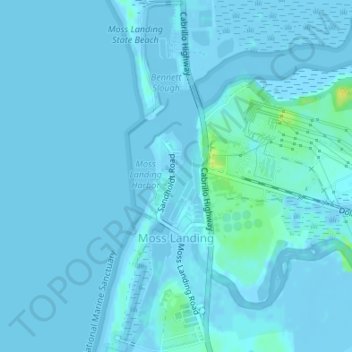
Nome: Mapa topográfico Moss Landing, altitude, relevo.
Altitude média: 1 m
Altitude mínima: -6 m
Altitude máxima: 18 m