
Mapa topográfico Landgoed Hoekelum
Mapa interativo
Clique no mapa para exibir a altitude.
Sobre este mapa
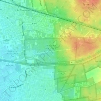
Nome: Mapa topográfico Landgoed Hoekelum, altitude, relevo.
Altitude média: 30 m
Altitude mínima: 13 m
Altitude máxima: 56 m
Outros mapas topográficos
Clique em um mapa para visualizar sua topografia, sua altitude e seu relevo.
De Kraats
Nederland > Gelderland > Bennekom
De Kraats, Bennekom, Ede, Gelderland, Nederland, 6721 NJ, Nederland
Altitude média: 10 m
Hoekelum
Nederland > Gelderland > Bennekom
Hoekelum, Bennekom, Ede, Gelderland, Nederland, 6721 ML, Nederland
Altitude média: 21 m