Geolocalizar

Mapa topográfico Armstrong Creek

Mapa interativo

Clique no mapa para exibir a altitude.

Sobre este mapa

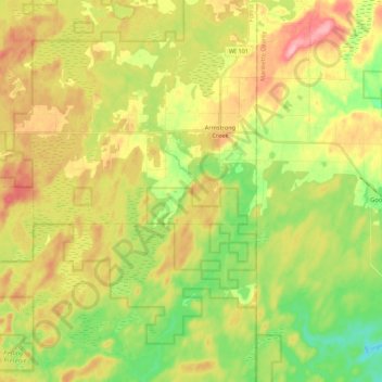
Nome: Mapa topográfico Armstrong Creek, altitude, relevo.

Local: Armstrong Creek, Town of Armstrong Creek, Forest County, Wisconsin, 54103, United States (45.55927 -88.48966 45.70991 -88.43004)

Altitude média: 447 m

Altitude mínima: 391 m

Altitude máxima: 511 m

Outros mapas topográficos

Clique em um mapa para visualizar sua topografia, sua altitude e seu relevo.

Franklin Lake

United States > Wisconsin > Forest County

Franklin Lake, Town of Hiles, Forest County, Wisconsin, United States

Altitude média: 523 m

Argonne

United States > Wisconsin > Forest County

Argonne, Town of Argonne, Forest County, Wisconsin, 54511, United States

Altitude média: 497 m