
Mapa topográfico Forbesganj
Mapa interativo
Clique no mapa para exibir a altitude.
Forbesganj
Forbesganj is located at 26°18′N 87°15′E / 26.3°N 87.25°E / 26.3; 87.25.[4] It has an average elevation of 46 meters (150 feet). The Nepalese border is only 12 km away.
Sobre este mapa
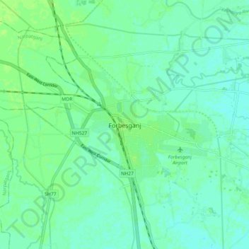
Nome: Mapa topográfico Forbesganj, altitude, relevo.
Local: Forbesganj, Araria, Bihar, 854318, India (26.26491 87.22328 26.34491 87.30328)
Altitude média: 61 m
Altitude mínima: 56 m
Altitude máxima: 65 m