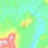
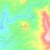
Mapa topográfico Star Valley
Clique no mapa para exibir a altitude.
Star Valley
According to the United States Census Bureau, the town has a total area of 36.1 square miles (93.6 km2), of which 0.01 square miles (0.02 km2), or 0.03%, is water. Star Valley sits at an elevation of 4,650 feet (1,420 m) and takes its name from the valley in which it is located, formed by Houston Creek, which descends to the south through Tonto National Forest to Tonto Creek, a tributary of the Salt River. The town was incorporated as the Town of Diamond Star, but changed its name to Star Valley in 2006.
Sobre este mapa

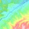
Nome: Mapa topográfico Star Valley, altitude, relevo.
Local: Star Valley, Gila County, Arizona, United States (34.21713 -111.27992 34.30436 -111.20321)
Altitude média: 1.509 m
Altitude mínima: 1.221 m
Altitude máxima: 1.933 m
Outros mapas topográficos
Clique em um mapa para visualizar sua topografia, sua altitude e seu relevo.




Star Valley
United States > Arizona > Gila County > Star Valley
According to the United States Census Bureau, the town has a total area of 36.1 square miles (93.6 km2), of which 0.01 square miles (0.02 km2), or 0.03%, is water. Star Valley sits at an elevation of 4,650 feet (1,420 m) and takes its name from the valley in which it is located, formed by Houston Creek, which…
Altitude média: 1.521 m