

Mapa topográfico Tehran Province
Clique no mapa para exibir a altitude.
Sobre este mapa
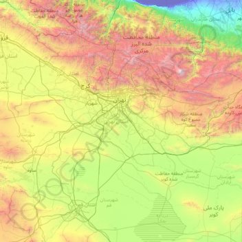
Nome: Mapa topográfico Tehran Province, altitude, relevo.
Local: Tehran Province, Iran (34.86524 50.33279 36.10161 53.15690)
Altitude média: 1.435 m
Altitude mínima: -29 m
Altitude máxima: 5.455 m
Outros mapas topográficos
Clique em um mapa para visualizar sua topografia, sua altitude e seu relevo.


Kamal
Iran > East Azerbaijan Province > Bostanabad County > دهستان شبلی
Sahand is one of the highest mountains in Iranian Azerbaijan, in addition to being an important dormant volcano in the country. The Sahand mountains are directly south of Tabriz, the highest peak of which is Kamal at an elevation of 3,707 m (12,162 ft). Approximately 17 peaks can be accounted for as being over…
Altitude média: 3.335 m


Bampur
Iran > Sistan and Baluchestan Province > Bampour County > دهستان خیرآباد
It is located 330 miles (530 km) south-east of Kerman at an elevation of 1,720 feet (520 m) In 1911 its population was about 2,000 and it was the capital of the province. It is situated on the banks of the Bampur river which flows from east to west and empties itself about 70 miles (110 km) west into a hamun,…
Altitude média: 516 m
Zagros Mountains
Iran > Isfahan Province > Semirom County > Padena-ye Vosta RD
Altitude média: 3.846 m



Sarjangal
Iran > Sistan and Baluchestan Province > Zahedan County > دهستان کورین
Altitude média: 1.455 m


Pust Forush
Iran > Razavi Khorasan > Zeberkhan County > Zebarkhan Rural District
Altitude média: 1.361 m


Mansur-e Aqa'i
Iran > Kermanshah Province > Ravansar County > دهستان منصورآقایی
Altitude média: 1.749 m

Kordichal
Iran > Mazandaran Province > Kelardasht County > دهستان کلاردشت شرقی
Altitude média: 1.235 m
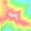
Tochal
Iran > Tehran Province > Shemiranat County > دهستان رودبار قصران
Tochal (Persian: توچال Točāl), is a mountain and ski resort located on the Alborz mountain range, adjacent to the metropolitan area of Tehran in northern Iran. It includes a 12-kilometre-long (7.5 mi) ridge. Its highest peak, also called Tochal, is at an elevation of 3,963 metres (13,002 ft) above sea level.
Altitude média: 3.561 m


Zagros Mountains
Iran > Isfahan Province > Semirom County > Padena-ye Vosta RD
Altitude média: 3.846 m




HajiAbad
Iran > Lorestan Province > Delfan County > East Kakavand Rural District > Haft Cheshmeh
Altitude média: 1.716 m


قلعه گبری (ایرج)
Iran > Tehran Province > Pishva County > Asgariyeh RD > عسگرآباد عباسی > قلعه گبری
Altitude média: 944 m


Kharvana
Iran > East Azerbaijan Province > Varzaqan County > دهستان دیزمارمرکزی
Altitude média: 1.489 m


Malek Abad
Iran > Sistan and Baluchestan Province > Zahedan County > دهستان حرمک
Altitude média: 957 m

Malekabad
Iran > Lorestan Province > Delfan County > دهستان میربگ شمالی > Cheraghabad
Altitude média: 1.797 m


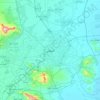
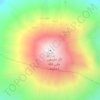
Damavand
Iran > Mazandaran Province > Amol County > دهستان لاریجان سفلی
Mount Damavand (Persian: دماوند [dæmɒːvænd] ) is a dormant stratovolcano and is the highest peak in Iran and Western Asia, the highest volcano in Asia, and the 3rd highest volcano in the Eastern Hemisphere (after Mount Kilimanjaro and Mount Elbrus), at an elevation of 5,609 metres (18,402 ft).…
Altitude média: 4.949 m


جاده میانکاله
Iran > Golestan Province > Torkaman County > South Chaparbay District > آشوراده
Altitude média: -27 m


Natanz
Iran > Isfahan Province > Natanz County > دهستان کرکس
Natanz is located 120 km northeast of Isfahan and on the main north-south highway of Iran. Its altitude is 1666 meters above sea level. The distance between Tehran and Natanz is 326 km, and it takes about 4 hours by car. The Karkas mountain chain (Kuh-e Karkas) (meaning mountain of vultures), at an elevation…
Altitude média: 1.775 m

Sabalan
Iran > Ardabil Province > Meshkinshahr County > دهستان لاهرود
At 4,794 metres (15,728 ft) in elevation, it is the third-highest mountain in Iran. It has a permanent crater lake formed at its summit. On one of its slopes around 3,600 metres (11,800 ft) in elevation there are large rock formations of eroded volcanic outcrops that resemble animals, birds, and insects.
Altitude média: 4.281 m






Iranian plateau
Iran > South Khorasan Province > Tabas County > دهستان دیهوک
The northwestern Iranian plateau, where the Pontic and Taurus Mountains converge, is rugged country with higher elevations, a more severe climate, and greater precipitation than are found on the Anatolian plateau. The region is known as the Anti-Taurus, and the average elevation of its peaks exceeds 3,000 m…
Altitude média: 1.061 m


Kermanshah
The province's capital is Kermanshah, located in the middle of the western part of Iran. The population of the city is 946,651 as of 2016. It is built on the slopes of Mt. Sefid Kooh and extended toward south during last two decades. The built-up areas run alongside Sarab River and Sarab Valley. The city's…
Altitude média: 1.054 m
Damavand
Iran > Mazandaran Province > Amol County > دهستان لاریجان سفلی
Mount Damavand (Persian: دماوند [dæmɒːvænd] ) is a dormant stratovolcano and is the highest peak in Iran and Western Asia, the highest volcano in Asia, and the 3rd highest volcano in the Eastern Hemisphere (after Mount Kilimanjaro and Mount Elbrus), at an elevation of 5,609 metres (18,402 ft).…
Altitude média: 4.949 m