
Mapa topográfico Blackball
Mapa interativo
Clique no mapa para exibir a altitude.
Sobre este mapa
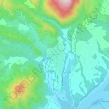
Nome: Mapa topográfico Blackball, altitude, relevo.
Local: Blackball, Grey District, West Coast, 7804, New Zealand (-42.38403 171.39195 -42.34403 171.43195)
Altitude média: 147 m
Altitude mínima: 29 m
Altitude máxima: 525 m
Blackball is a small town on the West Coast of the South Island of New Zealand, approximately 29 km from Greymouth. Elevation is approximately 100 metres. The town was named after the Black Ball Shipping Line, which leased land in the area to mine for coal.
Outros mapas topográficos
Clique em um mapa para visualizar sua topografia, sua altitude e seu relevo.
Greymouth
New Zealand > West Coast > Grey District
Greymouth, Grey District, West Coast, 7801, New Zealand
Altitude média: 40 m
Paddock Hill
New Zealand > West Coast > Grey District
Paddock Hill, Grey District, West Coast, New Zealand
Altitude média: 781 m