
Mapa topográfico Upper Bentley
Clique no mapa para exibir a altitude.
Sobre este mapa
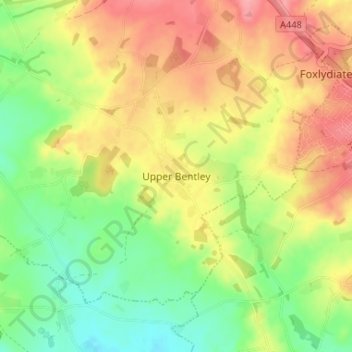
Nome: Mapa topográfico Upper Bentley, altitude, relevo.
Altitude média: 109 m
Altitude mínima: 65 m
Altitude máxima: 154 m
Outros mapas topográficos
Clique em um mapa para visualizar sua topografia, sua altitude e seu relevo.
Lickey Hills Country Park
United Kingdom > England > Worcestershire > Bromsgrove > Cofton Hackett CP
Altitude média: 209 m