
Faça uma doação
Mapa topográfico Skokie
Clique no mapa para exibir a altitude.
Faça uma doação
Skokie
The Chicago "L"s Yellow Line terminates at the Dempster Street station in Skokie. Construction has been completed on a new Yellow Line train station at Oakton Street, to serve downtown Skokie and environs. It opened on April 30, 2012. Additionally, the CTA is commissioning an Alternative Analysis Study on the extension of the Yellow Line terminal to Old Orchard Road for Federal Transit Administration New Start grants. The New Starts program allows federal funds to be used for capital projects provided that all solutions for a given problem (i.e., enabling easy transportation for reverse commuters to Old Orchard Mall) are considered. The solution recommended by the CTA is the elevation of the Yellow Line north of Searle Parkway to a rebuilt Dempster Street station, then following abandoned Union Pacific Railroad tracks and the east side of the Edens Expressway to a new terminal south of Old Orchard Road. Currently this solution needs to undergo public commenting as well as FTA and CTA board approval to continue.
Faça uma doação
Sobre este mapa
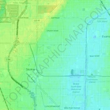
Nome: Mapa topográfico Skokie, altitude, relevo.
Local: Skokie, Niles Township, Cook County, Illinois, United States (42.00455 -87.78088 42.06514 -87.70853)
Altitude média: 190 m
Altitude mínima: 181 m
Altitude máxima: 200 m
Faça uma doação
Outros mapas topográficos
Clique em um mapa para visualizar sua topografia, sua altitude e seu relevo.
Faça uma doação
Faça uma doação
Faça uma doação
Faça uma doação
Faça uma doação
Chicago, North Shore & Milwaukee
United States > Illinois > Cook County > Northbrook > Williamsburg Square
Altitude média: 198 m
Faça uma doação
Elmwood Park
United States > Illinois > Cook County > Elmwood Park > Elmwood Park
Altitude média: 194 m
Faça uma doação