
Mapa topográfico West Rutland
Mapa interativo
Clique no mapa para exibir a altitude.
Sobre este mapa
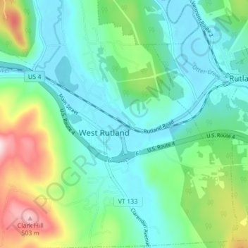
Nome: Mapa topográfico West Rutland, altitude, relevo.
Local: West Rutland, Rutland County, Vermont, 05777, United States (43.57037 -73.06800 43.61950 -73.02223)
Altitude média: 233 m
Altitude mínima: 141 m
Altitude máxima: 502 m
The town of Rutland was originally granted in 1761 as one of the New Hampshire Grants and named after Rutland, Massachusetts, the home of the first grantee, John Murrey. It was one of the most successful of those grants because of excellent farmland and gentle topography.