
Obrigado por apoiar este site ❤️
Faça uma doação
Faça uma doação
Mapa topográfico Prunedale
Clique no mapa para exibir a altitude.
Obrigado por apoiar este site ❤️
Faça uma doação
Faça uma doação
Prunedale
Prunedale is a census-designated place in Monterey County, California. Prunedale is located 8 miles (13 km) north of Salinas, at an elevation of 92 feet (28 m). The population was 17,560 residents at the time of the 2010 census, up from 16,432 at the 2000 census. Plum trees were grown in Prunedale in the early days of its founding but the trees died soon after due to poor irrigation and fertilizer.
Obrigado por apoiar este site ❤️
Faça uma doação
Faça uma doação
Sobre este mapa
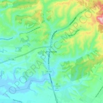
Nome: Mapa topográfico Prunedale, altitude, relevo.
Altitude média: 69 m
Altitude mínima: -8 m
Altitude máxima: 275 m
Obrigado por apoiar este site ❤️
Faça uma doação
Faça uma doação