
Obrigado por apoiar este site ❤️
Faça uma doação
Faça uma doação
Mapa topográfico Red Earth Creek
Clique no mapa para exibir a altitude.
Obrigado por apoiar este site ❤️
Faça uma doação
Faça uma doação
Red Earth Creek
Red Earth Creek is a hamlet in Alberta, Canada within the Municipal District of Opportunity No. 17. It is located east of Highway 88, between the town of Slave Lake and the hamlet of Fort Vermilion, and has an elevation of 520 metres (1,710 ft).
Obrigado por apoiar este site ❤️
Faça uma doação
Faça uma doação
Sobre este mapa
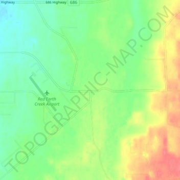
Nome: Mapa topográfico Red Earth Creek, altitude, relevo.
Altitude média: 549 m
Altitude mínima: 526 m
Altitude máxima: 584 m
Obrigado por apoiar este site ❤️
Faça uma doação
Faça uma doação