
Obrigado por apoiar este site ❤️
Faça uma doação
Faça uma doação
Mapa topográfico Tabok
Clique no mapa para exibir a altitude.
Obrigado por apoiar este site ❤️
Faça uma doação
Faça uma doação
Tabok
It is one of the two (the other one being the municipality of Consolacion) local government units located within the mainland Metro Cebu where the elevation of land is less than 100 m (330 ft).
Obrigado por apoiar este site ❤️
Faça uma doação
Faça uma doação
Sobre este mapa
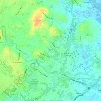
Nome: Mapa topográfico Tabok, altitude, relevo.
Local: Tabok, Mandaue, Central Visayas, 6014, Philippines (10.34199 123.93683 10.35486 123.94983)
Altitude média: 15 m
Altitude mínima: -1 m
Altitude máxima: 39 m
Obrigado por apoiar este site ❤️
Faça uma doação
Faça uma doação
Outros mapas topográficos
Clique em um mapa para visualizar sua topografia, sua altitude e seu relevo.
Canduman
It is one of the two (the other one being the municipality of Consolacion) local government units located within the mainland Metro Cebu where the elevation of land is less than 100 m (330 ft).
Altitude média: 37 m