
Mapa topográfico Tenkiller Ferry Lake
Mapa interativo
Clique no mapa para exibir a altitude.
Sobre este mapa
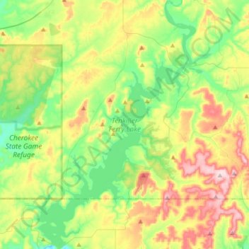
Nome: Mapa topográfico Tenkiller Ferry Lake, altitude, relevo.
Altitude média: 258 m
Altitude mínima: 150 m
Altitude máxima: 448 m
The hydroelectric power station is remotely controlled from the control center at Fort Gibson Lake. Two generators, each rated for 17 megawatts, provide a total capacity of 34 megawatts (MWe). The facility can handle 40 MWe for a short period of time. However, the amount of power that can actually be generated depends heavily on the lake elevation at any given time.