
Mapa topográfico Fuhai
Mapa interativo
Clique no mapa para exibir a altitude.
Fuhai
The Altai Mountains traverses Fuhai County, and the two main rivers in the county are the Ulungu Lake and the Irtysh River. Ulungu Lake is located in Fuhai County. The county's elevation ranges from 386 to 3,332 m (1,266 to 10,932 ft), with an average elevation of about 500 m (1,640 ft).
Sobre este mapa
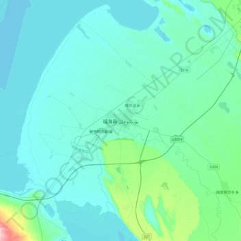
Nome: Mapa topográfico Fuhai, altitude, relevo.
Local: Fuhai, Fuhai County, Altay Prefecture, Xinjiang, 836400, China (46.95149 87.32375 47.27149 87.64375)
Altitude média: 504 m
Altitude mínima: 479 m
Altitude máxima: 715 m