Mapa topográfico La Chapelle-Iger
Mapa interativo
Clique no mapa para exibir a altitude.
Sobre este mapa
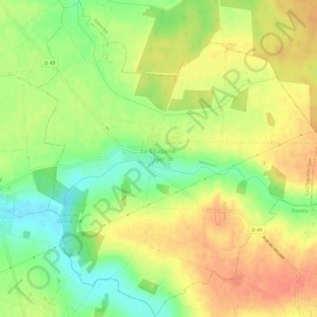
Nome: Mapa topográfico La Chapelle-Iger, altitude, relevo.
Altitude média: 113 m
Altitude mínima: 88 m
Altitude máxima: 132 m

Clique no mapa para exibir a altitude.
Nome: Mapa topográfico La Chapelle-Iger, altitude, relevo.
Altitude média: 113 m
Altitude mínima: 88 m
Altitude máxima: 132 m