
Mapa topográfico Odenthal
Mapa interativo
Clique no mapa para exibir a altitude.
Sobre este mapa
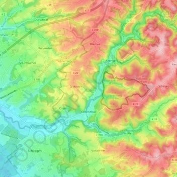
Nome: Mapa topográfico Odenthal, altitude, relevo.
Altitude média: 143 m
Altitude mínima: 60 m
Altitude máxima: 237 m
Der Ort ist auf der Topographischen Aufnahme der Rheinlande von 1824, auf der Preußischen Uraufnahme von 1840 und ab der Preußischen Neuaufnahme von 1892 auf Messtischblättern regelmäßig als Odenthalverzeichnet.